|
 Trat
is sandwiched by mountain ranges to the east and coastlines to the
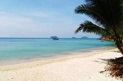
west with well-preserved natural beauty. It is blessed with 52 islands
which scatter like jewels along the Gulf of Thailand. Bangkok
lies 315 km to the northwest and Trat itself covers an area of 2,819
sq km. It contains 5 districts--Muang, Khao Saming, Laem Ngob, Klong
Yai and Bo Rai-- with the addition of 2 sub-districts, Koh Chang and
Koh Kood. Trat
is sandwiched by mountain ranges to the east and coastlines to the
west with well-preserved natural beauty. It is blessed with 52 islands
which scatter like jewels along the Gulf of Thailand. Bangkok
lies 315 km to the northwest and Trat itself covers an area of 2,819
sq km. It contains 5 districts--Muang, Khao Saming, Laem Ngob, Klong
Yai and Bo Rai-- with the addition of 2 sub-districts, Koh Chang and
Koh Kood.
Koh Chang,
often called the Elephant Island because its shape on the map looks
like an elephant head.
is
Trat's largest island, is the second largest in Thailand, behind
Phuket. The island is about 30 km long and almost 14 km wide.
The interior of the island is mountainous and covered with tropical
rainforest, with the
highest elevation being Khao Salakphet, at 743 metres above sea level.
In
1982, the island and its 51 surrounding small islands came under
protection as part of the Koh Chang Marine National Park. About 85% of
the island is given the national park designation, which is mostly
rainforest found inside the island. Animals in the park include the
stump-tailed macaque, the small Indian civet, the Javanese mongoose
and around 61 resident bird species. The Koh Chang wart frog is native
to the islands and the mainland of Trat as well.
|
![]() website.
website.