|
 Ko
Samet (Thai: เกาะเสม็ด), is
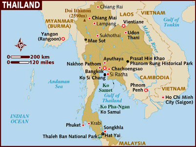
an island located in the Gulf of Thailand off the coastline of the
Thai province of Rayong, approximately 220 km southeast of Bangkok. Ko
Samet is located in the Phe (Thai: เพ)
District of the Amphoe Mueang Rayong (Thai:
เมืองระยอง, the capital district,
or Amphoe Mueang), of Rayong province. Ko
Samet (Thai: เกาะเสม็ด), is
an island located in the Gulf of Thailand off the coastline of the
Thai province of Rayong, approximately 220 km southeast of Bangkok. Ko
Samet is located in the Phe (Thai: เพ)
District of the Amphoe Mueang Rayong (Thai:
เมืองระยอง, the capital district,
or Amphoe Mueang), of Rayong province.
The island derives its name from the
cajeput tree found throughout the island, as the Thai language word
for cajeput is samet (the cajeput tree is formally known
in Thai ต้นเสม็ดขาว). In the past, this island has also been referred
to by its colloquial name, Ko Kaew Phitsadan (Thai:
เกาะแก้วพิศดาร), or the "Magic
Crystal Island".
 Popular
with foreign tourists and as a weekend getaway for residents of nearby
Bangkok, most of the island (excluding the Na Dan area) belongs to the
Khao Laem Ya - Mu Ko Samet National Park. In 1981, the Royal Forest
Department declared the archipelago of Samet, along with nine other
small islands, the headland of Khao Laem Ya, and 11 kilometer Mae
Rampeung Beach to be a National Park, and is thus Ko Samet is under
the protection of the National Parks Division of the Thai Government. Popular
with foreign tourists and as a weekend getaway for residents of nearby
Bangkok, most of the island (excluding the Na Dan area) belongs to the
Khao Laem Ya - Mu Ko Samet National Park. In 1981, the Royal Forest
Department declared the archipelago of Samet, along with nine other
small islands, the headland of Khao Laem Ya, and 11 kilometer Mae
Rampeung Beach to be a National Park, and is thus Ko Samet is under
the protection of the National Parks Division of the Thai Government.
Ko Samet is approximately 13.1 km2
in size, and shaped somewhat like a letter "t". Along the length of
the "t" (north-south) the island measures approximately 7 km, and
measures 4 km across the "t" (west-east).
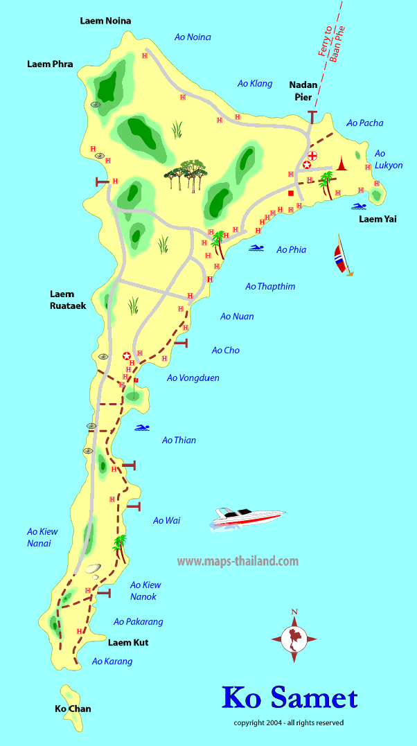
Closest to the Rayong coast, lies the
small island port village of Na Dan, commonly known as Ko Samet
Village, with its popular nearby beach Hat Sai Gaew (Thai:
หาดทรายแก้ว), the longest beach
on Ko Samet. Most of Ko Samet's beaches lie along the eastern shore of
the island. Other beaches on the island include: Ao Phai, Ao Wai, Ao
Kui Na Nai, Ao Kui Na Nok, Ao Vong Duern, Cape Khut, Ao Toei, and Ao
Korang at the southern tip, and Ao Prao on the western shore of the
island. Just off the souther tip of the island are three small
rock-islands, Ko Jan (Moon Island; Thai:
เกาะจันทร์ ), Ko San Chalam (Shark Fin Island), and Hin Khao
(White Rock; Thai: เกาะหินขาว ). |
![]() website.
website.